-
 Outreach and Awareness raising
This pillar is to ensure that adequate awareness and outreach activities are undertaken to better engage policymakers, administrators, entrepreneurs, scientists and civil society at all levels in using EO and geospatial data and information.
view
A plan for 20,000 weather stations in Africa
27 July 2024
The Trans-African HydroMeteorological Observatory (TAHMO) hopes to expand the continent’s weather-watching capacity, transforms the culture of African climate observations and the capacity for scientific discovery, by deploying weather stations at every 30kmHow climate is changing in Africa? How diseases spread? What are the water needs and the water flows? How groundwater is recharged? What could be the immediate and long term effects of extreme weather/climatic events... Weather data are essential to answer many question connected to a…
view
Experiences and results of users of Earth Observation data f…
27 July 2024
Experiences and results of users of Earth Observation data from Sentinel2 tabled for discussion among scientific and research communities in Rabat, Morocco.It was discussed during the international workshop on the Contribution of Sentinel2 Satellite Imagery for Research and applications for managing Environmental resources in Africa. The workshop ran from 06 to 08 February 2018, in Rabat, Morocco.GMES and Africa Support Programme is a pan-African Earth observation programme that uses Earth Observation data and information from Sentinel…
view
Marine User Handbook for Sentinel-3 users available online
27 July 2024
A user guide that summarises key information required to enable both general users and technical users to get information about marine altimetry products, from Sentinel-3 is made available online.The Marine User Handbook is produced by the EUMETSAT. The handbook describes available information on components of the altimetry system. It also discusses measurement techniques. The user Handbook is designed for current and potential users of Copernicus Marine Data Stream that are interested in the Sentinel-3 altimetry products for use in open…
view
Get trained to Radar Remote Sensing with ESA ECHOES in Space
27 July 2024
Echoes from space can take you on a journey through the exciting world of Radar Remote Sensing. The learning is self-paced. Registration is open during all the course. You can also pick up learning when the time is right for you.EO College is developed by the Friedrich-Schiller University in Jena, Germany and is sponsored by ESA. With ECHOES you can learn the basics that will help you to understand where this technology is coming from, how the images are acquired and which manifold applications already use Radar Remote Sensing to help protect…
view
Earth Observation for the growth of Blue Economy in Africa
27 July 2024
The possible contributions of Earth Observation applications for Blue growth in Africa under the GMES & Africa Support programme was tabled for discussionat the Africa GIS Conference, being held at the United Nations Economic Commission for Africa’s Conference Center, in Addis Ababa, Ethiopia. The Africa GIS 2017 Conference brings together policy makers, academia, private sectors, EO data providers and partners in the field of Earth Observation from Africa and the world.
In his keynote presentation the GMES & Africa Support…
view
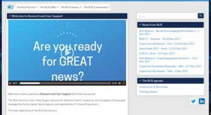
The Copernicus Research and User Support (RUS) Service porta…
27 July 2024
The RUS Service is the “New Expert Service for Sentinel Users” funded by the European Commission, managed by the European Space Agency, and operated by CS SI and its partners.
The main objectives of the RUS Service are:
To promote the uptake of Copernicus data;
To support the scaling up of R&D activities with Copernicus data.
To fulfil these objectives, t…