• A team discussing around media supports
    Outreach and Awareness raising

    This pillar is to ensure that adequate awareness and outreach activities are undertaken to better engage policymakers, administrators, entrepreneurs, scientists and civil society at all levels in using EO and geospatial data and information.

view

Save the date: Sentinel 3B will be launched on April 25th

The Sentinel-3 satellites carry the same suite of cutting-edge instruments to measure oceans, land, ice and atmosphere. Sentinel-3A has been in orbit since February 2016 and will be joined by Sentinel-3B on April 25th. The Sentinel-3 mission is at the heart of operational oceanography. It provides measurements to monitor aquatic biological productivity and marine pollution, to map sea-level change and to forecast the sea state for efficient and safe ship routing.It has been designed as a two-satellite constellation to give optimum global…
view

Experiences and results of users of Earth Observation data f…

Experiences and results of users of Earth Observation data from Sentinel2 tabled for discussion among scientific and research communities in Rabat, Morocco.It was discussed during the international workshop on the Contribution of Sentinel2 Satellite Imagery for Research and applications for managing Environmental resources in Africa. The workshop ran from 06 to 08 February 2018, in Rabat, Morocco.GMES and Africa Support Programme is a pan-African Earth observation programme that uses Earth Observation data and information from Sentinel…
view

Marine User Handbook for Sentinel-3 users available online

A user guide that summarises  key information  required to enable both general users and technical  users to get information about marine altimetry products, from Sentinel-3 is made available online.The Marine User Handbook is produced by the EUMETSAT. The handbook describes available information on components of the altimetry system. It also discusses measurement techniques. The user Handbook is designed for current and potential users of Copernicus Marine Data Stream that are interested in the Sentinel-3 altimetry products for use in open…
view

Copernicus helps reduce the risk of coastal flooding and ero…

Conservation, management and restoration of ecosystems and vegetated foreshores can help reduce the risk of coastal flooding and erosion. Free and open data from Copernicus helps to monitor vegetation characteristics, wave attenuation, sedimentation and erosion.Data and information from Copernicus Programme offer a unique opportunity to deploy operational services that support more sustainable and cost-effective mitigation strategies.One of the thematic priorities of the Global Monitoring for Environment and Security and Africa (GMES &…
view

GMES & Africa discusses usage and applications of Copern…

Experts from Africa and Europe discusses how the Global Monitoring of Environment and Security & Africa Support Programme can adapt and use Earth Observation data from Sentinel satellites.The discussion is going on in a workshop organized by the Copernicus and the GMES & Africa programme for the upcoming three consecutive days (19-21 February 2018) in Accra, Ghana.GMES &Africa Support Programme is the African Union Commission’s Earth Observation flagship programme and the key component of the EU-AU Partnership (Lisbon, 2007) in the…
view

Sentinel monitors Harmful Algal Blooms

When colonies of microscopic algae grow out of control in the water bodies, Harmful Algal Blooms (HABs) can occur. HAB produce toxins that cause massive fish deaths, poison shellfish beds, and contribute to human illness and death. Thanks to Sentinel-3's , it is possible to track HABs.Sentinel-3's Ocean and Land Colour Instrument (OLCI) sees and detect Harmful Algal Blooms (HABs) by using ocean color measurements.OLCI allows biogeochemical measurements like concentrations of Chlorophyll a — the photosynthetic pigment of phytoplankton (algae…
view

A year of achievements and Copernicus plans for 2018

If 2017 has been a landmark year in the history of the Copernicus programme, more will come in 2018. In an Editorial published on 12/01/2018, Philippe Brunet, Director for Space Policy Copernicus and Defence at EC's DG GROW explains.The offer of products and services has dramatically increasedThere is now over 743 Copernicus information products – actio nable geoinformation and intelligence - that are available from Copernicus for the support of environmental security and policies. And there is six core Copernicus services impacting citizens…
view

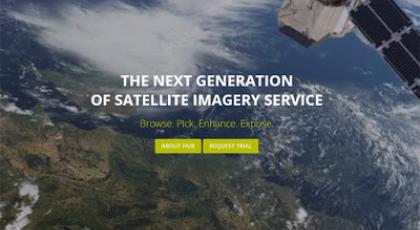
Sentinel hub - 1 year free earth observation data

ESA has partnered with Sentinel Hub to offer your business 1 year free and easy access to a wide range of EO data and 10 hours of support to help you build new services.Sentinel Hub is a simple and efficient way of archiving, processing and distributing satellite data using standard web services that can be easily integrated in any desktop, web or mobile mapping …
view

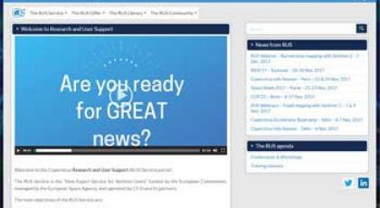
The Copernicus Research and User Support (RUS) Service porta…

The RUS Service is the “New Expert Service for Sentinel Users” funded by the European Commission, managed by the European Space Agency, and operated by CS SI and its partners. The main objectives of the RUS Service are:   To promote the uptake of Copernicus data; To support the scaling up of R&D activities with Copernicus data. To fulfil these objectives, t…
view

Join the Copernicus Academy and Relays Networks!

Do you want to engage with the European Commission at a national, regional and local level to foster Copernicus user uptake and market development? The Commission is launching a call for expression of interest to open two Copernicus Networks to new members... To unleash the full potential of the Copernicus Open Data and Information, the European Commission is run…
view

Sentinel-2 cloudless mosaic: the first global (almost) cloud…

EOX IT Services, an Austrian Open Source solution provider for Earth Observation services, has implemented a methodical process crafting an almost cloudless Sentinel-2 map of the world   About 70 per cent of the Earth’s surface is covered by clouds any given day. Imagery obtained by satellite sensors operating in the visible light range is constantly constraine…
view

Copernicus assists in monitoring risks and planning for resp…

A recent example on how data provided by the Copernicus Marine Environment Monitoring Service can contribute to the Regional Marine Pollution Emergency Response Centre for Mediterranean Sea (REMPEC)In March 2017, following an armed attack on the oil port of Es Sider in Libya, the Regional Marine Pollution Emergency Response Centre for Mediterranean Sea (REMPEC) activated the Mediterranean Operational Network for the Global Ocean Observing System (MONGOOS) services to simulate the worst-case scenario in the case of a potential oil spill…
view

A wealth of Copernicus training videos at your disposal

A total of 68 training videos complete with presentations and module demonstrations on the Copernicus programme - such as material on funding instruments, access to Copernicus data and information and the many uses thereof - are at the disposal of Entrepreneurs, developers, GI professionals and public authorities, as well as all interested stakeholders. One of the many ways in which the European Commission is promoting the Copernicus programme and developing user uptake of Copernicus data and information is by organising Copernicus Training…
view

GMES and Africa visits ESA-ESRIN

Following the invitation of ESA/ESRIN, the GMES and Africa team -composed of the Project Management Unit (PMU) and the Technical Assistance Team (TAT) - performed a visit to ESRIN headquarters in Frascati, Italy on the 3rd and 4th of July, 2017. The coordination meeting in ESRIN aimed at (1) presenting ESA and its EO activities in Africa to GMES & Africa team, (2) presenting the project GMES & Africa team to ESA’s Experts and (3) Discussing about perspectives of cooperation between ESA and AUC.The discussions were constructive and…