• A team discussing around media supports
    Outreach and Awareness raising

    This pillar is to ensure that adequate awareness and outreach activities are undertaken to better engage policymakers, administrators, entrepreneurs, scientists and civil society at all levels in using EO and geospatial data and information.

view

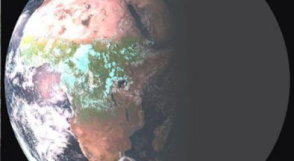
A plan for 20,000 weather stations in Africa

The Trans-African HydroMeteorological Observatory (TAHMO) hopes to expand the continent’s weather-watching capacity, transforms the culture of African climate observations and the capacity for scientific discovery, by deploying weather stations at every 30kmHow climate is changing in Africa? How diseases spread? What are the water needs and the water flows? How groundwater is recharged? What could be the immediate and long term effects of extreme weather/climatic events... Weather data are essential to answer many question connected to a…
view

Experiences and results of users of Earth Observation data f…

Experiences and results of users of Earth Observation data from Sentinel2 tabled for discussion among scientific and research communities in Rabat, Morocco.It was discussed during the international workshop on the Contribution of Sentinel2 Satellite Imagery for Research and applications for managing Environmental resources in Africa. The workshop ran from 06 to 08 February 2018, in Rabat, Morocco.GMES and Africa Support Programme is a pan-African Earth observation programme that uses Earth Observation data and information from Sentinel…
view

Establishment of Humanitarian and Early Warning Mechanisms i…

The African Union Commission and various stakeholders and partners have been discussing the establishment of integrated and continental Humanitarian and Early Warning Mechanisms in Africa, at a workshop which ran from 26 to 28 February 2018, in Nairobi, Kenya. The theme of the workshop was “African Union: A Decade of Humanitarian Action (2016-2025)”.The GMES & Africa Programme Coordinator and Space Science expert, Dr. Tidiane Ouattara, briefed participants on the potential contribution of Earth Observation through the GMES & Africa…
view

Marine User Handbook for Sentinel-3 users available online

A user guide that summarises  key information  required to enable both general users and technical  users to get information about marine altimetry products, from Sentinel-3 is made available online.The Marine User Handbook is produced by the EUMETSAT. The handbook describes available information on components of the altimetry system. It also discusses measurement techniques. The user Handbook is designed for current and potential users of Copernicus Marine Data Stream that are interested in the Sentinel-3 altimetry products for use in open…
view

Copernicus helps reduce the risk of coastal flooding and ero…

Conservation, management and restoration of ecosystems and vegetated foreshores can help reduce the risk of coastal flooding and erosion. Free and open data from Copernicus helps to monitor vegetation characteristics, wave attenuation, sedimentation and erosion.Data and information from Copernicus Programme offer a unique opportunity to deploy operational services that support more sustainable and cost-effective mitigation strategies.One of the thematic priorities of the Global Monitoring for Environment and Security and Africa (GMES &…
view

A year of achievements and Copernicus plans for 2018

If 2017 has been a landmark year in the history of the Copernicus programme, more will come in 2018. In an Editorial published on 12/01/2018, Philippe Brunet, Director for Space Policy Copernicus and Defence at EC's DG GROW explains.The offer of products and services has dramatically increasedThere is now over 743 Copernicus information products – actio nable geoinformation and intelligence - that are available from Copernicus for the support of environmental security and policies. And there is six core Copernicus services impacting citizens…
view

Get trained to Radar Remote Sensing with ESA ECHOES in Space

Echoes from space can take you on a journey through the exciting world of Radar Remote Sensing. The learning is self-paced. Registration is open during all the course. You can also pick up learning when the time is right for you.EO College is developed by the Friedrich-Schiller University in Jena, Germany and is sponsored by ESA. With ECHOES you can learn the basics that will help you to understand where this technology is coming from, how the images are acquired and which manifold applications already use Radar Remote Sensing to help protect…
view

Earth Observation for the growth of Blue Economy in Africa

The possible contributions of Earth Observation applications for Blue growth in Africa under the GMES & Africa Support programme was tabled for discussionat the Africa GIS Conference, being held at the United Nations Economic Commission for Africa’s Conference Center, in Addis Ababa, Ethiopia. The Africa GIS 2017 Conference brings together policy makers, academia, private sectors, EO data providers and partners in the field of Earth Observation from Africa and the world.   In his keynote presentation the GMES & Africa Support…
view

Transforming land-based resource management: the role of GME…

Extreme weather events, climate change, land degradation, droughts and floods severely affect the Earth, and Africa is severely impacted by these environmental challenges.   As a result land based natural resources among others are at risk. Ultimately, the socioeconomic development of its people are threatened. Improved environmental and natural resources manage…
view

Join the Copernicus Academy and Relays Networks!

Do you want to engage with the European Commission at a national, regional and local level to foster Copernicus user uptake and market development? The Commission is launching a call for expression of interest to open two Copernicus Networks to new members... To unleash the full potential of the Copernicus Open Data and Information, the European Commission is run…
view

GMES and AFRICA participates in the AMCOMET Africa Hydromet…

This inaugural African Ministerial Conference on Meteorology (AMCOMET) – Africa Hydromet Forum was held in Addis Ababa to provide strategic insight towards Africa’s climate and disaster resilience through improvement of hydrological, meteorological and early-warning services.    Co-hosted by the African Union Commission and the Federal Democratic Republic of E…
view

GMES and Africa visits ESA-ESRIN

Following the invitation of ESA/ESRIN, the GMES and Africa team -composed of the Project Management Unit (PMU) and the Technical Assistance Team (TAT) - performed a visit to ESRIN headquarters in Frascati, Italy on the 3rd and 4th of July, 2017. The coordination meeting in ESRIN aimed at (1) presenting ESA and its EO activities in Africa to GMES & Africa team, (2) presenting the project GMES & Africa team to ESA’s Experts and (3) Discussing about perspectives of cooperation between ESA and AUC.The discussions were constructive and…
view

GMES and AFRICA participates in the conference “Space Soluti…

Invited by the European Space Agency, the Coordinator was given the opportunity to present how GMES and Africa can contribute to a more prosperous and integrated Africa and what could be the innovative benefits from Copernicus data use.About the conferenceOn 26 October 2016, the European Union (EU) issued its Space Strategy for Europe and signed a Joint Statement with the European Space Agency, which together aim to maximize the integration of space into European society and economy, by increasing the use of space technologies and applications…